
Project 4 - All-Season Road Connecting Berens River to Poplar River First Nation
Public Notice
Project 4 - All-Season Road Connecting Berens River to Poplar River First Nation — Public Comments Invited
March 1, 2017 — The Canadian Environmental Assessment Agency (the Agency) is conducting a federal environmental assessment of the proposed Project 4 - All-Season Road Connecting Berens River to Poplar River First Nation, located in Manitoba.
The Agency invites the public to comment on the draft Environmental Assessment Report, a document that includes the Agency's conclusions and recommendations regarding the potential environmental effects of the project, the proposed mitigation measures, the significance of adverse environmental effects, and the follow-up program.
The Agency also invites the public to comment on the potential environmental assessment conditions for the project. These conditions would become legally binding on the proponent if the Minister of Environment and Climate Change ultimately issues a decision statement indicating the project may proceed.
All comments received will be considered public.
Written comments must be submitted by March 31, 2017 to:
Project 4 - All-Season Road Connecting Berens River to Poplar River First Nation
Canadian Environmental Assessment Agency
Canada Place
9700 Jasper Avenue, Suite 1145
Edmonton, Alberta T5J 4C3
Telephone: 780-495-2037
Email: CEAA.Project4-Projet4.ACEE@ceaa-acee.gc.ca
To view the draft Environmental Assessment Report and potential conditions, visit the Agency's website (Registry reference number 80094).
Copies are also available for viewing at the following locations:
- Berens River First Nation Band Office
Berens River, Manitoba - Manitoba Legislative Library
200 Vaughan Street, Room 100
Winnipeg, Manitoba - Millennium Public Library
4th Floor, 251 Donald Street
Winnipeg, Manitoba - Poplar River First Nation Band Office
Poplar River, Manitoba
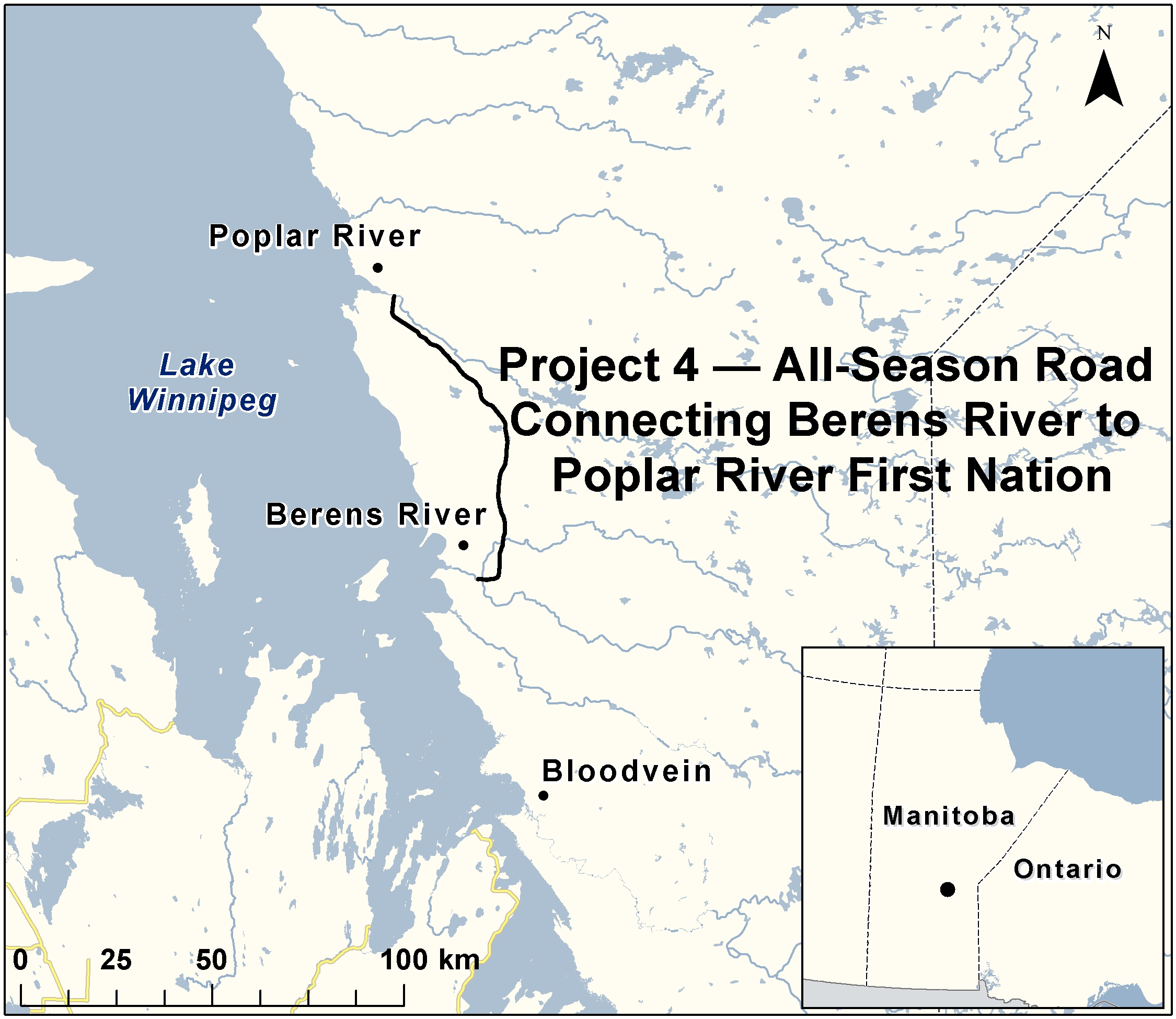
The proposed project
Manitoba Infrastructure proposes to construct an all-season road on provincial Crown land, designed as a 2-lane gravel public highway approximately 94 kilometres in length. As proposed, the road would begin near the Berens River First Nation, on the east side of Lake Winnipeg, Manitoba, and extend north on the south side of the Berens River to the Poplar River First Nation reserve boundary. Four major water crossings (bridges) over the Berens, Etomami, North Etomami, and Leaf Rivers, would also be constructed as part of the project.
Document reference number: 21