
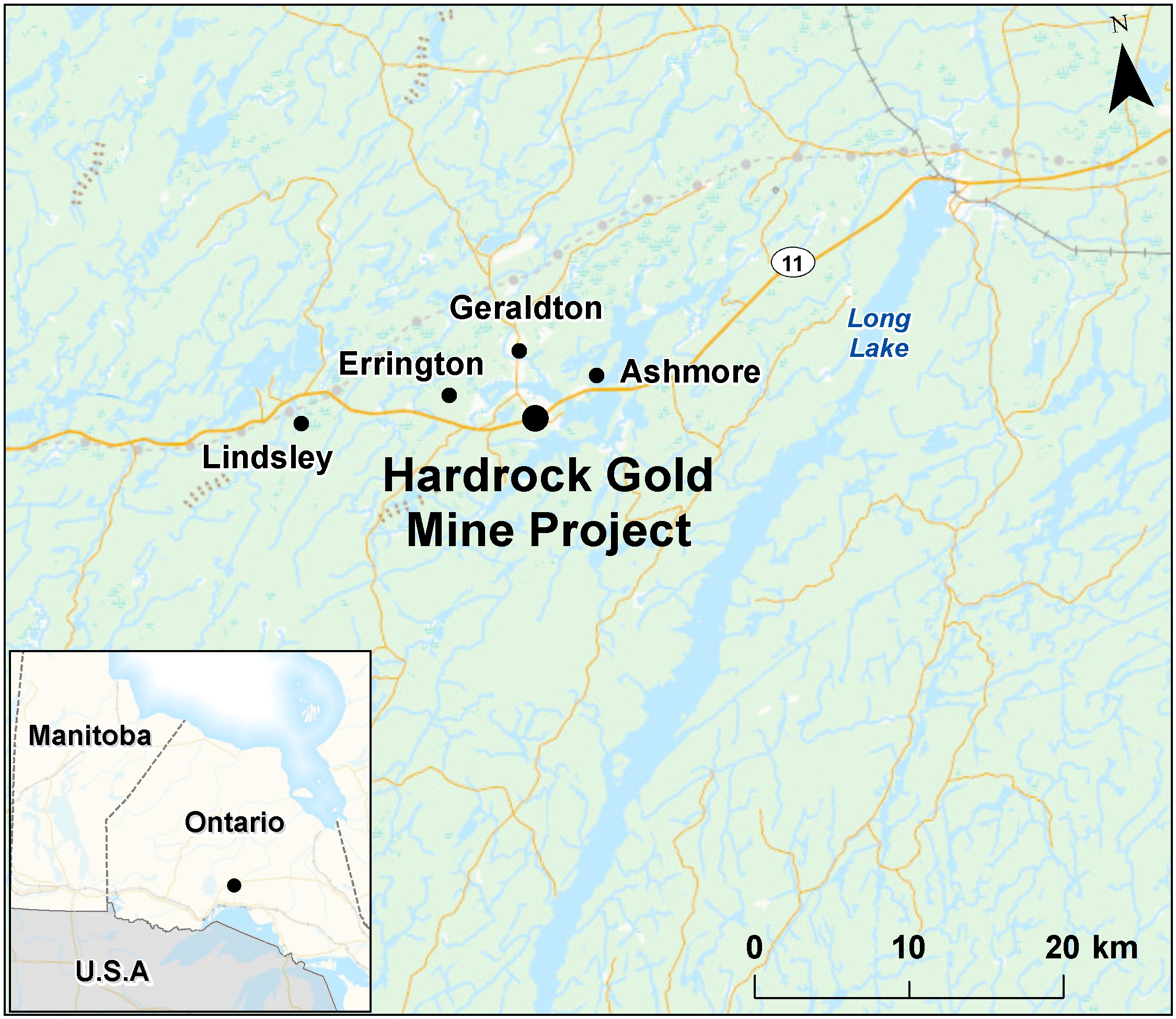
Hardrock Gold Mine Project
Greenstone Gold Mines is proposing the construction, operation, decommissioning, and abandonment of an open-pit gold mine and on-site metal mill located approximately five kilometres south of Geraldton, Ontario, at the intersection of Highway 11 (Trans-Canada Highway) and Michael Power Boulevard. As proposed, the gold mine would have an ore production capacity of 30,000 tonnes per day, and the metal mill would have an ore input capacity of 30,000 tonnes per day.
Please note that this project was formerly known as the Hardrock Deposit Project.
Please note that the proponent was formerly known as Premier Gold Mines Hardrock Inc.
Latest update
Participate
Key documents
| Document Number | Document Title | File | Date |
|---|---|---|---|
| 45 | Amended Decision Statement | PDF (936 KB) | February 10, 2021 |
Contacts
Compliance Promotion & Follow-up TeamImpact Assessment Agency of Canada
160 Elgin Street, 22nd Floor
Ottawa, Ontario K1A 0H3
Email: postdecision@iaac-aeic.gc.ca
-
Location
- Geraldton (Ontario)
-
Nature of Activity
- Mines and Minerals
-
Assessment Status
Completed -
Start Date
2014-06-13 -
Proponent
Greenstone Gold Mines (formerly Premier Gold Mines Hardrock Inc.) -
Authorities
- Impact Assessment Agency of Canada
-
Assessment Type
Environmental assessment under CEAA 2012 -
Reference Number
80068
Disclaimer
This map is for illustrative purposes. The markers represent the approximate locations based on available data. More than one marker may be identified for a given assessment.
Nearby assessments
...within 200 kilometres-
New Fibre Installation
Project Site 2 -
New Fibre Installation
Project Site 1 -
AZA Roadway Granular Procurement and Design-Build Construction
Animbiigoo Zaagi'igan Anishinaabek -
The Elders Lodge at Aroland First Nation
Aroland Elder's Lodge -
The BNA Road Access Project
Bingwi Neyaashi Anishinaabek -
Bingwi Neyaashi Anishinaabek (196) Lot Servicing and Pre-Construction
Bingwi Neyaashi Anishinaabek -
The BNA Three Phase Transmission Project
The BNA Three Phase Transmission Project -
Pays Plat New Housing Units
Pays Plat -
Marathon Palladium Project
Marathon -
Delineation and Soil Remediation at Hawkins Island Coast Guard Site, Lake Superior, Ontario
Hawkins Island -
Marten Falls Community Access Road Project
Northern end of Painter Lake forestry road -
Soil Remediation at Slate Island Coast Guard Site, Patterson Island, Ontario
Slate Island, Ontario -
Lake Superior National Marine Conservation Area Discovery Centre
Lake Superior National Marine Conservation Area -
Pic River Roads Rehabilitation
Pic River Roads Rehabilitation -
Biigtigong Nishnaabeg Water Treatment System Project
Biigtigong Nishnaabeg (Ojibways of the Pic River First Nation) -
Biigtigong Nishnaabeg New K4-8 School
Biigtigong Nishnaabeg First Nation -
Radio Tower Replacement at Administration Building
Pukaskwa National Park -
Backcountry Paddling Site Upgrades
Pukaskwa National Park of Canada -
Wetland Walkway Replacement - Hattie Cove
Pukaskwa National Park -
Wetland Walkway Replacement, additions to scope - Hattie Cove
Pukaskwa National Parc -
Pic Mobert - MHC Section 95 2018-2019 4 Units
Pic Mobert First Nation - North -
Netmizaaggamig Nishnaabeg - Subdivision Development
Netmizaaggamig Nishnaabeg-Subdivision Development -
Wharf Demolition, Hurkett, Ontario
Hurkett, Ontario -
Family Services Building
Netmizaaggamig Nishnaabeg - Pic Mobert Fist Nation - 195 -
Gull Bay Lagoon Expansion
Gull Bay Lagoon Expansion-Gull Bay First Nation -
Gull Bay First Nation Diesel Generating Station Upgrade
Kiashke Zaaging Anishinabe -
Gull Bay Roads Rehabilitation
Neebing -
Kiashke Zaaging Anishinaabek - Small Scale Waste Transfer Design and Construction
Kiashke Zaaging Anishinaabek (Gull Bay) First Nation -
Whitesand Elder's Unit (6-Plex)
Whitesand First Nation -
Stormwater Management (SWM) Infrastructure Remediation
Armstrong -
Ginoogaming KM 132 Bridge Replacement
Ginoogaming KM 132 Bridge -
Replacement of the Superior West Weather Radar
Shuniah, ON